


For decades, Earth-orbiting satellites have given scientists an invaluable view of the planet’s icy worlds from above. NASA’s Landsat and the European Space Agency’s Copernicus Sentinel missions have become key tools for understanding how glaciers—vast, moving rivers of ice—respond to climate change.
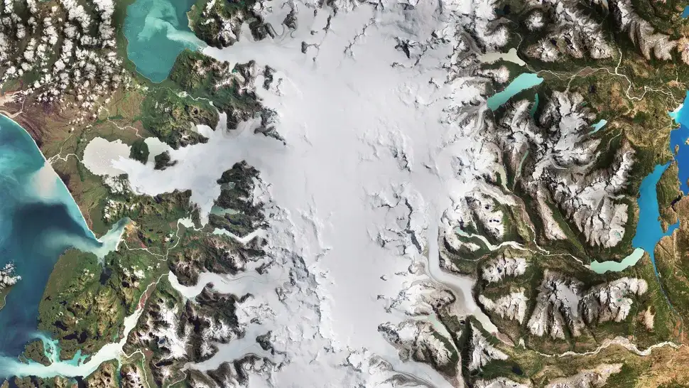
The European Space Agency recently released a satellite image of the Laguna San Rafael National Park in Chile. The park, which covers about 17,000 square kilometers, is located in Patagonia, on Chile’s Pacific coast. The glaciers here are fed by 28 glacial rivers, the largest of which are the San Rafael and San Quintin, shown here.
This phenomenon is not only changing the landscape of Patagonia but also has a direct global impact, contributing to rising sea levels, which is considered one of the most dangerous and irreversible consequences of climate change.